
Web Maps and GIS Services
Learning Objectives
- Understand the concept of integrating data layers from Web maps and GIS Services in map products
- Learn several methods to retrieve data from sources such as the Geography Network, other ArcIMS servers, or geographic data clearinghouses for use in ArcMap
- Describe types of services and how each are created
- Be knowledgeable of tools available to create layer and map packages in order to share data and maps
Problem
The problems are to create map documents using exercise data provided, a base map from one built into ArcMap, a map service from Arcgis.com, and a map service referenced through the NCSU Libraries OGC/WMS website. Layer packages and map packages are to be created, along with two JPEG maps exported from ArcMap.
Analysis Procedures
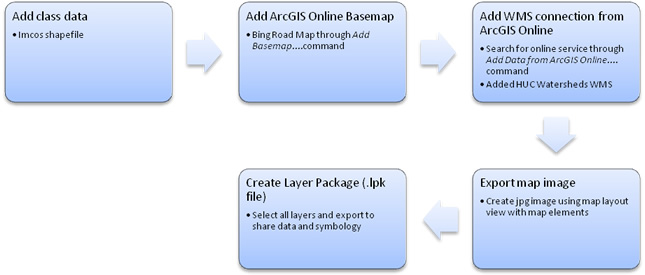
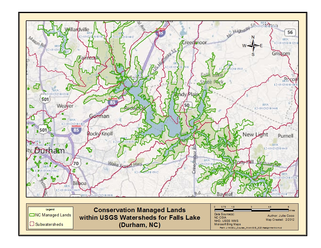
To solve the problems above, ArcGIS software was used to create two ArcMap documents. The first map included the exercise data, one of the built-in base maps in ArcMap, and another map service available from Arcgis.com. The exercise data is a statewide polygon shapefile of North Carolina lands managed for conservation and open space. Before starting in ArcMap, the map properties were changed to store files according to relative path names. For the first map, a base map was added to ArcMap’s table of contents through the Add Data, Add Basemaps… command. This brings up a series of thumbnail images representing different maps. The Bing Maps Road was chosen. To use another map service, choose the Add Data From ArcGIS Online… command. This brings up a dialog box to search or choose from a list of available layer and map packages shared online. Managed lands within specific USGS subwatersheds (according to hydrologic unit codes, or HUCs) around Falls Lake were chosen. To create the layer package, three layers were selected along with the Create Layer Package…command from the menu. The map was exported using a map layout template. The three layers within the document were saved offline and used to create a layer package (.lpk file).
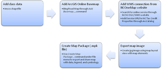
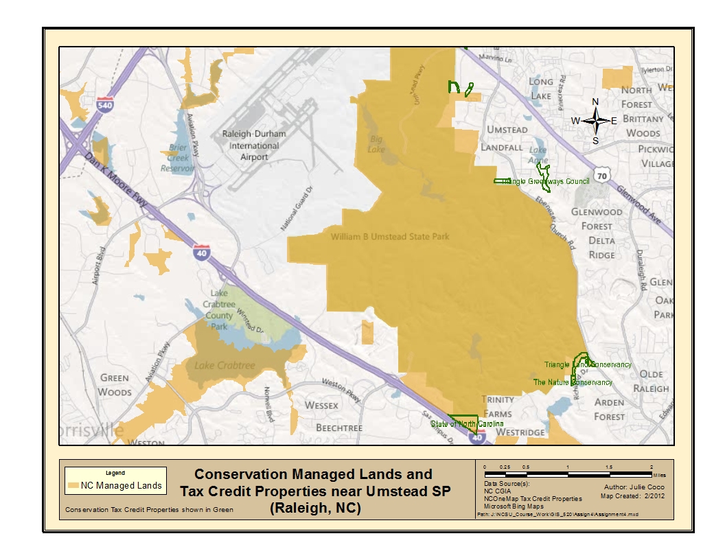
The second map included the exercise data, one of the built-in base maps in ArcMap, and another map service available from the NCSU OGC/WMS site. A map of conservation tax credit properties was chosen from the NCOneMap map server. This would allow one to see which managed lands were receiving tax credit. From the server page, the Service URL was pasted into the Add WMS Server dialog box under GIS Servers in ArcCatalog. North Carolina managed properties were given a transparency in order to see underlying basemap features. The same Bing map was used as the base map. The map was exported using a map layout template. The three layers within the document were used to create a map package (.mpk file) by selecting the File, Create Map Package...command, and following the instructions for adding a map description. This created a map package (.mpk file) for sharing not only data and symbology, but also the map layout view. The following diagrams illustrate these methods:
Map 1 Process Workflow
Map 2 Process Workflow
Results
The maps below use traditional GIS datasets in conjunction with basemaps from ArcGIS Online. In these cases, Bing road maps were used as basemaps to aid in referencing the data. Click the images to enlarge them.
Map 1
ArcGIS 10 users:
For access to the above map and data packaged as a map LAYER, click here.
Map 2
ArcGIS 10 users:
For access to the above map and data packaged as a map PACKAGE, click here.
Application and Reflection
As eluded to above, it might be helpful to know which lands managed for conservation and open space were given tax credits and which ones not currently granted, might be targeted for future qualification. Lands managed for conservation practices might be prioritized for improvements, or the practices defined based upon the condition of the watersheds in which they reside and their receiving waters.